


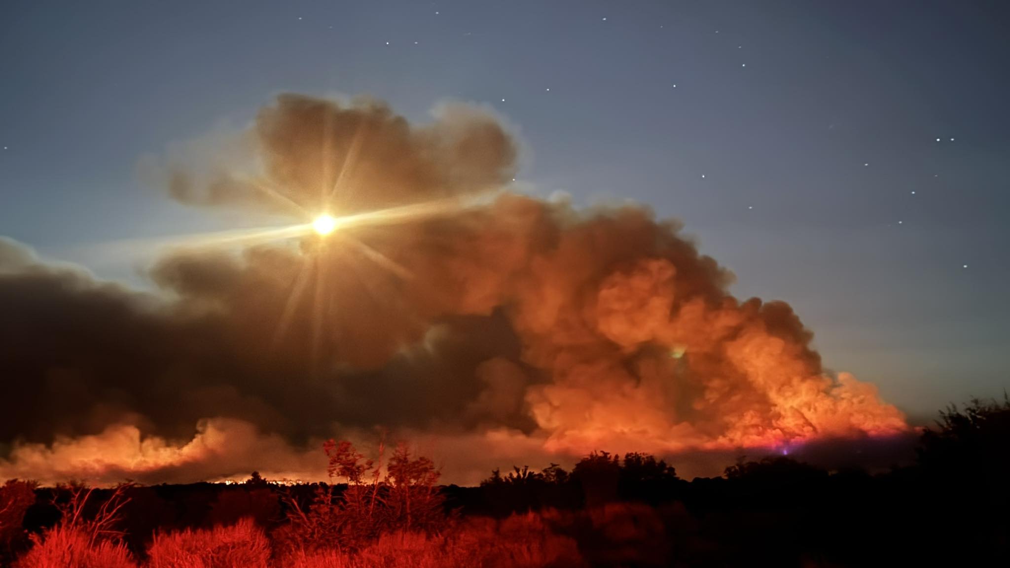
Five wildfires continued to burn across Colorado’s Western Slope on Wednesday with minimal containment, although firefighters managed to prevent more large runs of fire growth and protected almost all buildings from damage.
The Turner Gulch, Wright Draw, Deer Creek, South Rim and Sowbelly fires are burning on at least 20,866 acres in Mesa, Delta and Montrose counties, fueled by extremely dry trees, brush and grass. Several of the fires are burning in rugged, remote terrain that’s difficult, if not impossible, for fire crews to access.
Extreme drought conditions mean firefighters are contending with some of the driest conditions possible, fire behavior analyst Glen Lewis said at a community meeting for the Turner Gulch and Wright Draw fires in Gateway on Wednesday night.
Although there’s normally a monsoonal season in on the Western Slope at this point in the summer, no significant rain is expected in the next two weeks, he said.
Most of the central Western Slope remains under an air quality advisory for wildfire smoke until at least Thursday morning, according to the Colorado Department of Public Health and Environment.
The advisory includes Mesa, Garfield, Eagle, Pitkin, Lake, Delta, Gunnison, Chaffee, Montrose, San Miguel and Ouray counties.
Jump to: Turner Gulch fire | Wright Draw fire | Deer Creek fire | South Rim fire | Sowbelly fire
Turner Gulch fire and Wright Draw fire near Gateway
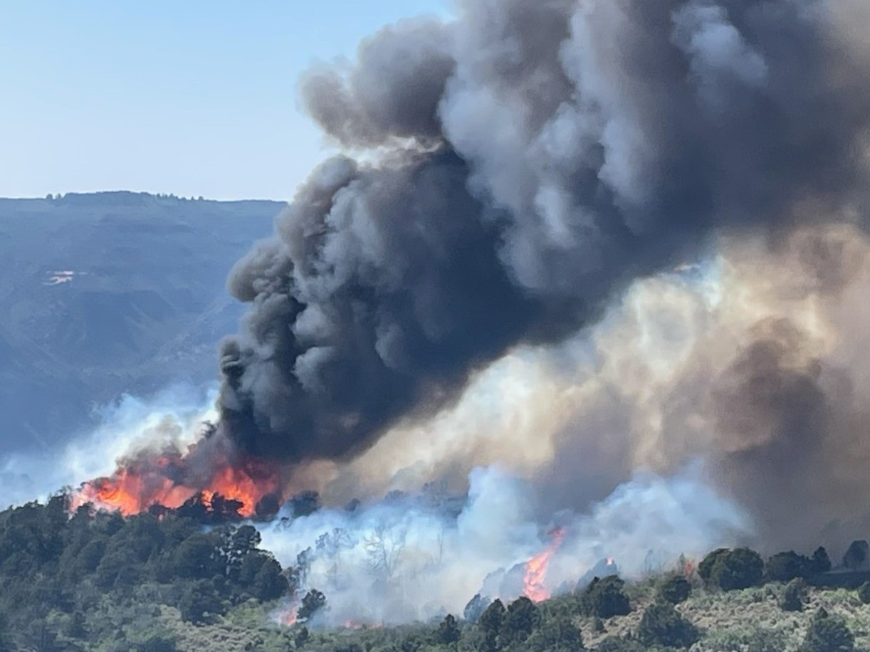
Mesa County’s Turner Gulch fire, which exploded in size late Monday night and early Tuesday, is burning on 13,984 acres with no containment, fire officials said Wednesday in Gateway.
The combination of extreme drought and high temperatures are similar to conditions on the deadly South Canyon fire, a 1994 wildfire near Glenwood Springs that killed 14 firefighters, said Lewis, the fire behavior analyst. Operations leaders are on high alert and are prioritizing firefighter safety, officials said Wednesday.
The Wright Draw fire, on the opposite side of Unaweep Canyon, is still burning on 448 acres, fire officials said.
The landscape around both lightning-sparked fires includes “unforgiving country” that makes it difficult or impossible for fire crews to enter or even plan around, operations section chief Travis Lipp said. There are at least 475 firefighters and other experts responding.
Fire officials are focusing on protecting homes and infrastructure and shoring up fire lines, and there may be some fire containment by Thursday, Lipp said.
Colorado 141 remains closed between 7.40 Road and 16.10 Road at mile marker 124 because of the fire, according to state transportation officials.
Land around Colorado 141 from mile marker 120 to mile marker 134 is under mandatory evacuation orders, according to Mesa County sheriff’s officials. The stretch between mile markers 134 and 137 remains under pre-evacuation orders.
Deer Creek fire near Paradox
The Deer Creek fire, which crept into Colorado from Utah, has burned more than 14,700 acres between the two states, fire officials said.
As of Wednesday morning, the wildfire was burning on 14,760 acres and was 7% contained. That’s another 1,800-acre jump from Tuesday, when Utah officials first reported the fire had crossed state lines.
Although it’s unknown how many acres the Deer Creek fire has scorched in Colorado, federal fire maps showed it was burning on a section of land more than two miles long and, at its widest, about two miles across.
The burn area is just north of Colorado 90 in Montrose County, near Paradox. It encompasses multiple county roads and parts of Ice Lake Creek and Lion Creek.
Dry thunderstorms and gusty winds fueled the fire’s overnight growth, fire officials said.
The fire has shut down Rimrocker Trail at Q13 Road and Good Road, U5 Road at the turn for the Buckeye Reservoir and X2 Road, according to Montrose County officials.
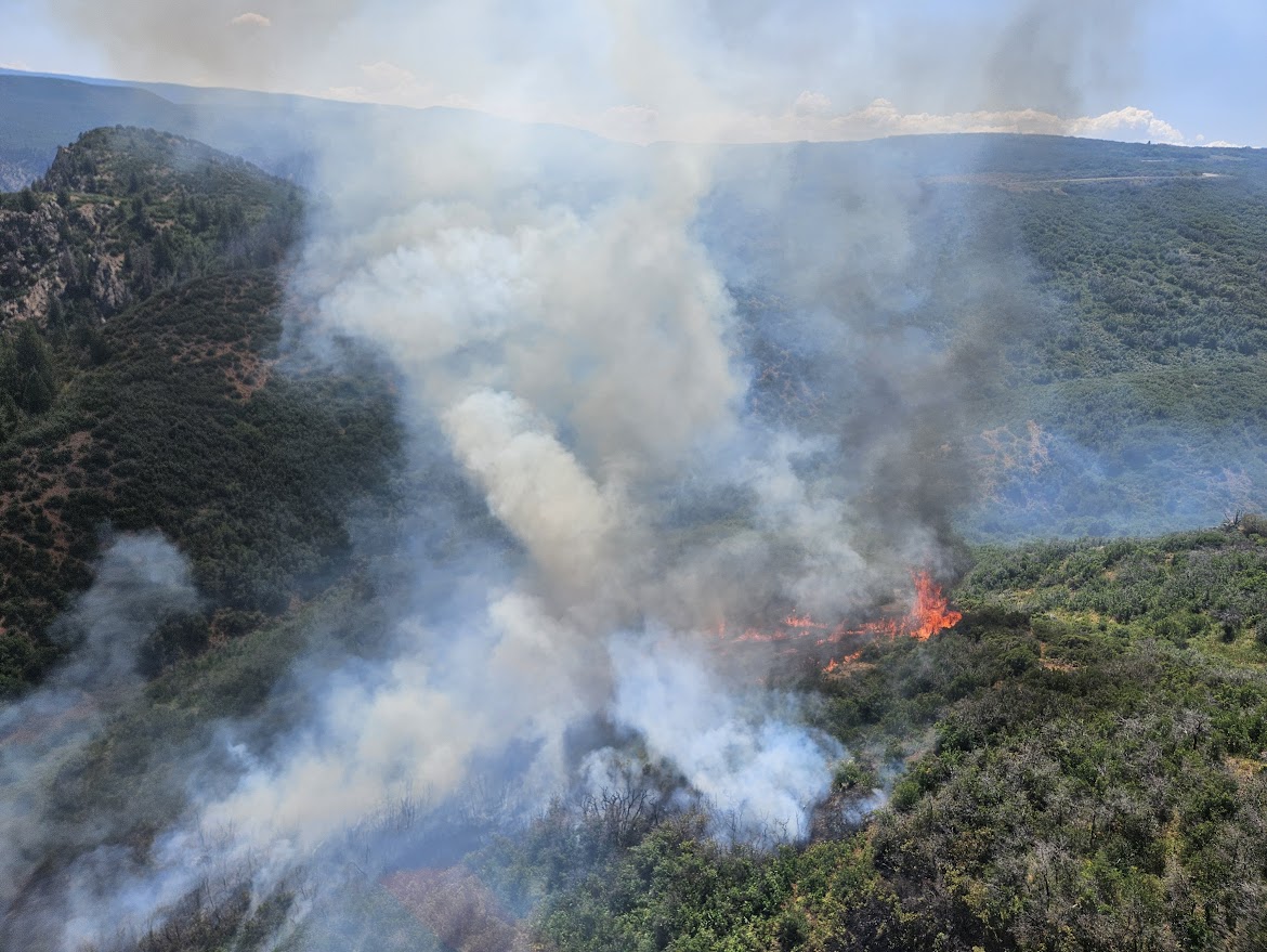
South Rim fire near Montrose
A wildfire that sparked in Black Canyon of the Gunnison National Park is burning on more than 4,000 acres with no containment, including most of the park’s south rim, according to fire officials.
The South Rim fire was last mapped at 4,160 acres in and around the park, Rocky Mountain Area Complex Incident Management Team 3 officials said Wednesday. Fire crews are making good progress on building fire lines and are focused on the western edge of the fire, although extremely steep terrain is making that difficult along the northwest side.
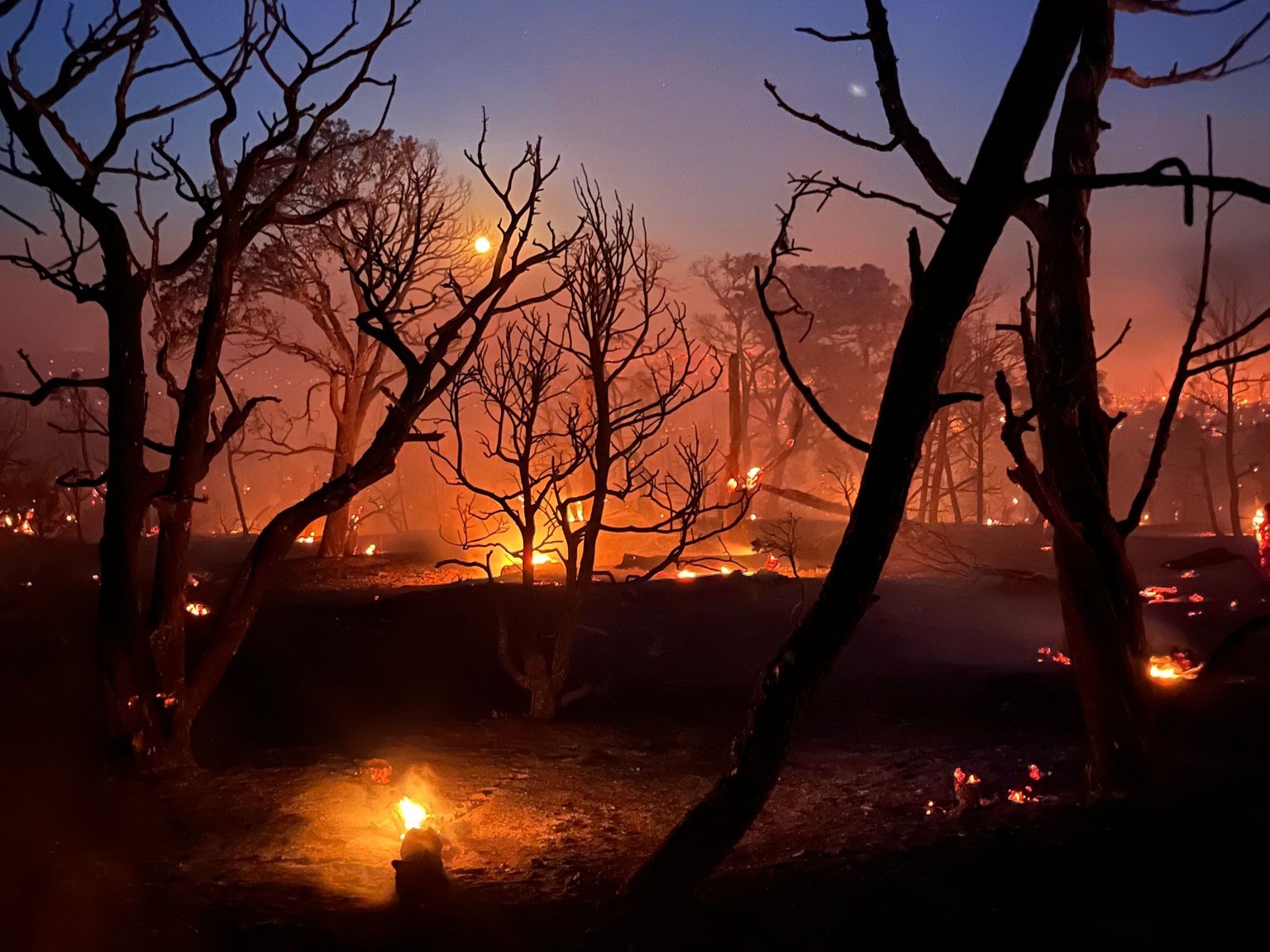
Flames have consumed about 85% of the Black Canyon’s south rim, park Superintendent Stuart West said at a community meeting Tuesday night at Grace Community Church in Montrose.
“It will look very different than when you saw it last time,” he told the crowd.
Although the visitor’s center is still standing, the fire destroyed a maintenance building and all of the park’s heavy equipment. No homes or structures in the nearby Bostwick Park area have been damaged.
The national park remains closed to the public with no timeline to reopen, and mandatory evacuations are in effect for nearby homes and trails, including the Bostwick Park area. All campground reservations for Black Canyon have been canceled for the rest of 2025, and the park will not be taking any new reservations, West said.
As of Monday morning, two zones — including a section north of U.S. 50 along Colorado 347 and an area between Rawhide Gulch and the Montrose Reservoir — were under pre-evacuation orders, according to a map created by Montrose County officials.
Even after the fire is under control, visitors will not be able to enter the inner canyon because of unstable rock, West said.
“We realize the Black Canyon is a valuable resource to this community and to the country and a return to normal is in everyone’s best interest, but it’s going to take quite some time,” he said.
Black Canyon of the Gunnison generates $35 million in revenue for the city and county of Montrose, emergency manager Scott Hawkins said.
Although the nearby Curecanti National Recreation Area is unscathed, about 500 acres of federal land is still at risk, Bureau of Land Management field office manager Jon Kaminsky said Tuesday night. The land includes habitat for the threatened Gunnison sage-grouse, livestock forage and areas of recreation, hunting and fishing.
The fire started early Thursday when a passing storm caused at least seven lightning strikes in the park, incident meteorologist Scott Stearns said. Although more storms moving through the area will bring some cloud cover and cooler temperatures through the weekend, they also bring a high threat of more lightning strikes, which could start new fires, and little chance of substantial rain to aid firefighters.
“This fire is still very active,” fire officials stated on Facebook. “Even with all the good work underway, it takes time — crews need to be confident the fireline will hold, especially in steep and challenging terrain.”
Abundant, extremely dry fuel sources are fueling the fire’s spread day, and night and debris rolling down the canyon is igniting areas below, sending flames rushing back up the steep slopes, officials said.
There isn’t an imminent threat of the fire reaching U.S. 50, but it’s not out of the question, Stearns said.
Resources fighting the fire include 420 people, 21 fire engines and helicopters and fixed-wing aircraft along with two scooper planes capable of picking up 1,412 gallons of water in 12 seconds.
Sowbelly fire near Delta
Fire crews gained 13% containment on the Sowbelly fire, which is burning on federal land along the border of three western Colorado counties, officials said Wednesday.
Firefighters also managed to stop the 2,274-acre wildfire from growing Wednesday, according to the Bureau of Land Management Colorado.
The fire is burning in the Dominguez-Escalante Canyon National Conservation Area, about 12 miles west of Delta near the edge of Montrose, Delta and Mesa counties.
Although the fire is mainly “creeping and smoldering,” gusty winds caused some fire torching. And scattered lightning halted firefighting efforts, officials said Wednesday. Fire crews are focused on keeping the fire from jumping north over ZS Road and spreading into Escalante Canyon.
Get more Colorado news by signing up for our Mile High Roundup email newsletter.


